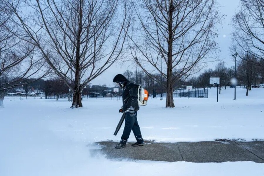
A historic winter storm has swept across the Midwest and Eastern United States, delivering record-breaking snowfall and widespread disruption. Communities in its path have faced significant challenges, including treacherous road conditions, airport delays, and closures of schools and government offices. As the storm barrels toward the East Coast, regions such as Washington, D.C., brace for up to a foot of snow, adding to the mounting difficulties.
The storm has already broken daily snowfall records in several states, including Kentucky, Missouri, Ohio, and West Virginia. Central New York has seen some of the most staggering totals, with preliminary measurements reporting more than 5 feet of snow in 24 hours. In Oneida County, New York, an astonishing 67 inches of snowfall has been recorded, leaving the area among the hardest-hit regions. Other areas in the Midwest have also been blanketed by significant snow, with Saint George, Kansas, reporting 18 inches, and Thompson Pass, Arkansas, recording 17 inches. Kansas City, Missouri, received 12 inches, while Cincinnati, Ohio, saw 8.4 inches of snow. In Louisville, Kentucky, snowfall totaled 7.7 inches, and Pendleton County, West Virginia, reported 8 inches.
As the storm shifts eastward, it is expected to bring considerable snowfall to the Mid-Atlantic region, including Maryland, Virginia, and Washington, D.C. Forecasts from the Baltimore-Washington National Weather Service office predict snowfall totals of up to 12 inches in some areas. Annapolis, Maryland, is expected to receive 11 inches, while Alexandria, Virginia, and Washington, D.C., could see between 6 and 10 inches. Baltimore, Maryland, and Atlantic City, New Jersey, are both forecast to receive 7 inches of snow. Early Monday morning, reports from the National Weather Service confirmed that snow is already accumulating in parts of the region, with Calvert County, Maryland, Stafford County, Virginia, and Pendleton County, West Virginia, each recording 8 inches of snowfall. Washington, D.C., reported 4.8 inches, and Baltimore measured 4 inches.
The storm has severely impacted travel across the affected areas. Authorities have reported deteriorating road conditions, with many highways blanketed by snow and ice. Officials are urging residents to stay off the roads unless travel is necessary. Snowplows are working tirelessly to clear the main thoroughfares, but heavy snowfall has made it difficult to keep up. Visibility remains poor in many regions, compounding the challenges faced by both drivers and emergency responders. Airports in the storm’s path have experienced significant delays and cancellations, leaving holiday travelers stranded and scrambling to make alternative arrangements.
Emergency services are on high alert, prepared to respond to weather-related incidents, including accidents and power outages. The storm’s intensity and the volume of snow have raised concerns about potential power disruptions, especially in areas with heavy accumulations of trees and power lines. Authorities are advising residents to stock up on essentials, prepare for possible outages, and monitor local weather updates for the latest information. Shelter arrangements are being made for those in need, particularly in areas expecting the heaviest snowfall and coldest temperatures.
A combination of Arctic air and atmospheric conditions conducive to heavy snowfall has fueled this powerful winter storm. In regions like New York, lake-effect snow has played a significant role, amplifying accumulations as cold air flows over warmer lake waters. The result has been localized but extreme snowfalls, particularly in areas downwind of the Great Lakes. While the Midwest grapples with the aftermath of record-breaking totals, the East Coast braces for the storm’s next phase, with cities preparing for significant disruptions in the days ahead.
Despite the challenges posed by the storm, communities are demonstrating resilience and solidarity. Residents are helping one another dig out from under record snowfalls, sharing resources, and supporting those most affected by the severe weather. The storm serves as a reminder of the power of nature and the importance of preparation and cooperation in the face of extreme conditions.
As the storm continues its path, forecasters caution that even as the snow begins to taper off, lingering cold temperatures and icy conditions will remain a hazard. Crews will work around the clock to clear roads, restore normalcy, and ensure public safety. The storm’s impacts will likely be felt for days, if not weeks, as affected regions recover from one of the most significant winter weather events in recent memory.

